BUILT TO EXPAND WHAT DRONES CAN DO WELL
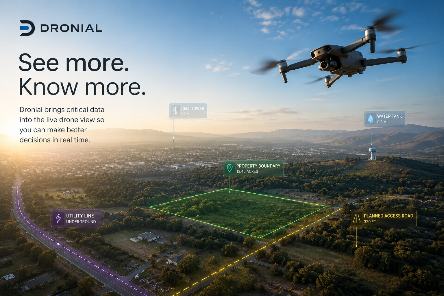
Dronial adds critical mapping and location data directly into the live drone view, helping pilots see more than the camera alone can show.
From property boundaries and construction layouts to outage markers, hidden infrastructure, and search locations, Dronial gives drone operators the context they need to work faster, navigate smarter, and take on missions that would otherwise be difficult — or impossible — with video alone. Learn More
Follow Our Momentum
⦁
Follow Our Momentum
Follow Our Momentum ⦁ Follow Our Momentum