
ABOUT DRONIAL
Dronial was founded on a simple observation: drones have become powerful tools for capturing the physical world, but critical information still lives on separate maps, plans, and software systems.
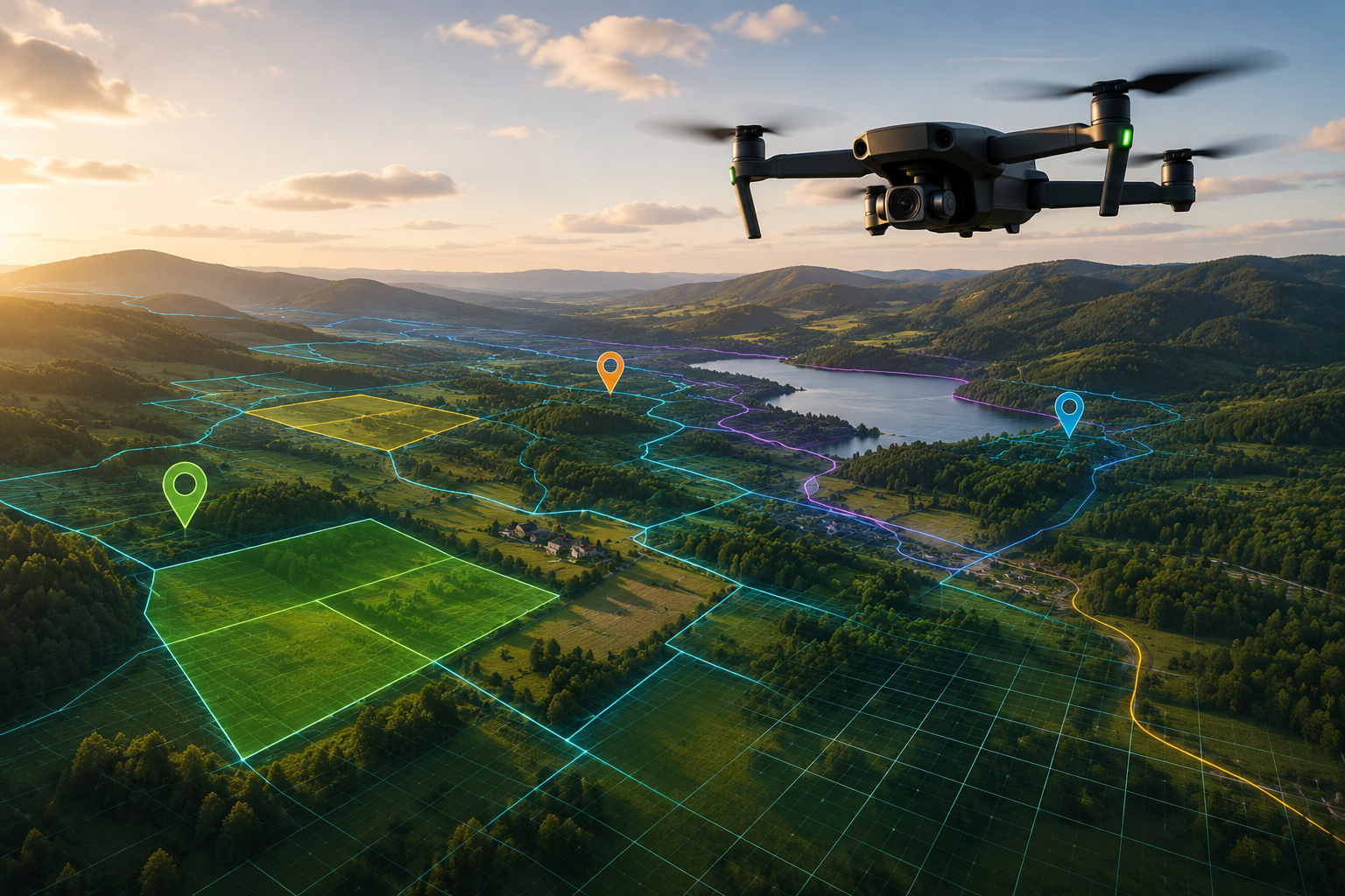
Whether reviewing property boundaries, locating infrastructure, inspecting assets, planning construction projects, or responding to field events, operators are often forced to divide their attention between the drone view and external data sources. Important context exists, but not where it is needed most.
Dronial seeks to bridge that gap
Our mission is to bring digital information into the live drone experience through augmented reality. By overlaying boundaries, markers, layouts, and location-based data directly onto drone footage, we help operators understand what they are seeing in real time and make better decisions in the field.
We believe drone technology is still in its early stages. As drones become more capable, the next step is not simply better cameras or longer flight times, it is providing pilots with meaningful context while they fly.
Dronial is building a platform of Drone AR applications designed for real-world commercial use cases. From land and real estate visualization to infrastructure inspection, utilities, construction, and public safety, our goal is to expand what drones can do by making critical information visible when and where it matters most.
The future of drone operations is not just seeing the world from above.
It's understanding it.
Ready to Revolutionize Your Drone Operations?
Drop your details. We would love to discuss how we can propel your business forward.
Want to talk now? Call us!
+1 (321) - D R O N I A L
9am-5pm CST